Cauvery Basin
• The Cauvery river originates at Talakaveri in the Brahmagiri range in the Kodagu district of Karnataka at an elevation of 1,341 m.
• It flows for about 800 km before draining into the Bay of Bengal.
• It is smaller in size compared to Godavari, Krishna, and Mahanadi rivers.
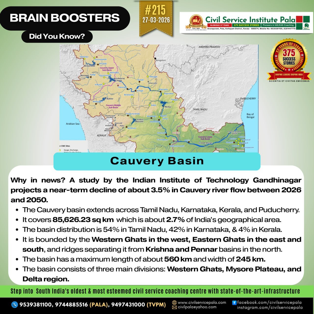
• The Cauvery basin extends across Tamil Nadu, Karnataka, Kerala, and Puducherry.
• It covers an area of 85,626.23 sq km, which is about 2.7% of India’s geographical area.
• The basin distribution is 54% in Tamil Nadu (including Karaikkal), 42% in Karnataka, and 4% in Kerala.
• It is bounded by the Western Ghats in the west, Eastern Ghats in the east and south, and ridges separating it from Krishna and Pennar basins in the north.
• The basin has a maximum length of about 560 km and width of about 245 km.
• Major left bank tributaries include Harangi, Hemavati, Shimsha, and Arkavati.
• Major right bank tributaries include Lakshmantirtha, Kabbani, Suvarnavati, Bhavani, Noyil, and Amaravati.
Physiographic Features of the Basin
• The basin consists of three main divisions: Western Ghats, Mysore Plateau, and Delta region.
• The Western Ghats region is mountainous and densely forested.
• The Mysore Plateau has an average elevation of about 750 m and slopes east/southeast.
• The delta region in Tamil Nadu is highly fertile and suitable for intensive agriculture.
Decline in Cauvery Water Flow
• A study by the Indian Institute of Technology Gandhinagar projects a near-term decline of about 3.5% in Cauvery river flow between 2026 and 2050.
• This decline contrasts with projections of increased flow in most major Indian rivers due to climate change.
• The study highlights that despite increased rainfall projections, the Cauvery basin may face water shortages in the near and mid-term.
• Historical data shows a 28% decline in Cauvery streamflow between 1951 and 2012 based on measurements at Kollegal.
• The findings are based on a constrained modelling approach, which improves accuracy by using observed data and filtering reliable climate models.
• Only 8 out of 22 climate models (CMIP6) were found reliable in capturing Indian monsoon seasonality.
• The study suggests that interlinking projects like the Godavari–Cauvery link may be required to address future shortages.
• The projected decline may intensify water-sharing conflicts between Karnataka and Tamil Nadu.
Water Dispute Context
• Long-standing disputes between Karnataka and Tamil Nadu led to the formation of the Cauvery Water Disputes Tribunal (1990).
• The tribunal gave its final award in 2007, estimating total water availability at 740 tmc ft.
• The 2018 Supreme Court judgment allocated 404.25 tmc ft to Tamil Nadu and 284.75 tmc ft to Karnataka.
• The court also declared the Cauvery as a national asset.
• In 2023, Tamil Nadu demanded 24,000 cusecs per day, which Karnataka refused citing shortage, leading to protests.